I'm spoiled. I admit it. No shame. Packing for a hotel trip was not fun. I've grown accustomed to packing just a few clothing items to replenish the camper each trip; for this weekends' hotel trip to Jekyll Island I had to remember to pack the deodorant, toothpaste, bicycle helmet . . . you get the picture. I forgot tennis shoes, beach towels, sunscreen. The well-stocked SolAire is mighty convenient!
Despite the "inconvenience" of packing and driving separately (the Chief attended a conference most of the week), the trip was worth the effort. Island life is so pleasant this time of year - cooler temps, a breeze, and great entertainment. The annual Shrimp & Grits Festival brought life to the historic district with bands, artisans, and plenty of food. Someone oversold the parking, so our Trooper buddy told us. I've never seen bumper to bumper traffic on Jekyll like I did morning, afternoon and evening yesterday. Glad we had our bicycles!
Bumper to bumper traffic in the roundabout on Jekyll Island
Friday evening we wandered down to the festival grounds to grab some dinner and catch the band's last set. The last rain shower of the week had soaked the island just prior to my arrival, so the puddles were full and the grass a bit soggy. We followed that with a nighttime walk on the beach; the tide was coming in and the strong breeze blowing was a tad cool.
We awoke early in hopes of witnessing a beautiful sunrise. Clouds threatened to derail the plan. What I photographed was gorgeous, even if it wasn't a fireball. Sunday's sunrise was more like what I was expecting, and I was thrilled to capture the rays.
Sunrise - Jekyll Island, GA - Saturday, September 19, 2015
Morning twilight - Jekyll Island, GA - Sunday, September 20, 2015
This fella stopped to pose for his portrait.
While the Chief finished his business at the convention center Saturday morning, I checked out the new shops in the recently completed village. If you haven't been to Jekyll recently, you need to plan a trip. Much progress has been made in the last few years; a new convention center, shopping village, new and restored motels & hotels. The historic district has been restored, too.
Sidney Lanier Bridge
Browsing became buying when I discovered Caroline's. She had some things I've been contemplating buying for a while, so .... Now I have that Nantucket basket for my bicycle - deep enough & strong enough to hold my camera and some Amazing Grace wind chimes for the SolAire (almost got the Big Ben, too, but couldn't justify two sets in one day).
Fun morning of shopping at Caroline's in the village on Jekyll Island.
I also picked up a pair of FitKicks; not sure if I'm far behind on fashion or on the cutting edge - these were new to me. Quite honestly, they're ugly, but the package showed all the things you can do in them - like bike riding. I had forgotten to pack my tennis shoes and I knew that we would ride bikes to the festival after lunch and I didn't want to walk the festival in my bicycle clips, so this was a perfectly necessary purchase. They are comfortable; I've had them on ever since. Like wearing Spandex socks with a plastic sole.
Evening twilight at St. Mary's, GA - Saturday, September 19, 2015
We headed off the island Saturday evening in search of a new adventure. We discovered music in the park in St. Mary's and a picturesque sunset. We returned by way of the Kings' Bay Naval Base, my chauffeur hoping to show me the submarine at the base's entrance. No lights! Left us wondering whether the lights were in need of repair or the government is saving a few dollars on electricity.
Hoda Kodbe & Jenna Bush Hager announced on Labor Day that one sunset picture is all you should post on Facebook - more is overkill, but I figure anyone who's read this far doesn't mind how many sunset photos I post, so I've loaded up some of my best shots from the weekend. Enjoy!
Sunrise - Jekyll Island, GA - Sunday, September 20, 2015
Heading south out of Bainbridge, we drove the densely forested scenic route along Hutchinson Ferry Road and Booster Club Road. The road is built atop a ridge and we could see the steep descent to the lake. We continue to be amazed by the dramatic shift in terrain from the area where we live to this area which is so close to home.
The approach to the campground was straight downhill and offered a dramatic view of the lake. I found out just how steep the entrance is on Saturday when my bicycle brakes failed to slow me and I had to take evasive action.
Our first view of Lake Seminole as we approached on Friday evening.
Eastbank Campground located on Lake Seminole is less than a two hour drive from our home. Despite having crossed the bridge at Chattahoochee, FL, nearly every trip to the beach of our lives, we had never explored the Lake Seminole area.
The campground, which is situated at the southernmost end of the lake, affords a lovely view of the sunset across the water.
Evening sun gilds the lake
The confluence of the Flint and Chattahoochee rivers forms the Apalachicola River which runs to the Gulf of Mexico. The Jim Woodruff Dam creates the lake. Our campsite had a nice view of the dam, and, of course, on Saturday, we explored the dam on our bikes.
Biking the dam at Lake Seminole
Jim Woodruff Dam
Public access for fishing
After exploring the dam, we ventured further into Florida for some more sightseeing.
A theme is emerging here: we've biked across state lines several times this summer!
Crossing the state line on the dam
The short ride parallel to the river took us directly to River Landing Park featuring oaks draped with Spanish moss, the old highway bridge - a portion of which still stands as it was too costly to tear down, remnants of a fort from the War of 1812, and a single surviving Indian mound from centuries ago.
Our initial view of the old bridge
River Landing Park in Chattahoochee, FL
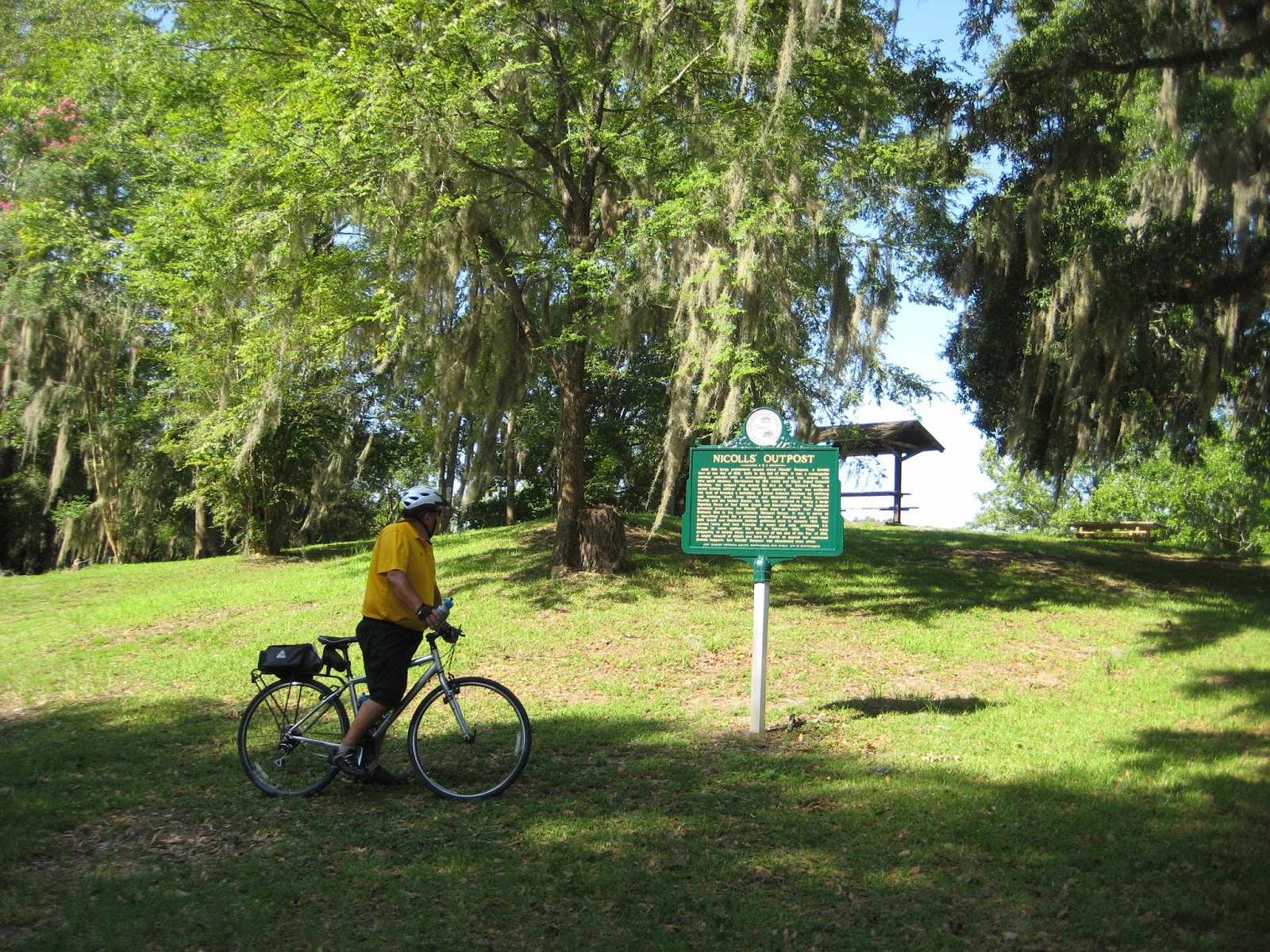
Reading the historic marker to learn about the significance of the site
A British fort of the War of 1812 was established here
Prehistoric Indian mound located in River Landing Park along the Apalachicola River
We spent some time looking at the flood markers. Jamie reminisced about 1998; he was on patrol in the area. He claims to have a photo of the flood waters from atop the dam stored away somewhere in his memorabilia. Time will tell if he can produce it ~ and a postscript is sure to follow if, in fact, he does.
Flood markers painted on the column of the old bridge
A marker erected in the park indicates flood levels
A closeup view shows the water level above 76 feet on July 10, 1994, March 12, 1998 and March 26, 1929
We started our ascent to the top of the ridge into the town of Chattahoochee, FL. We made it about a third of the way before we ran out steam. We recently rode 126 miles in the "mountains" of Pennsylvania, Maryland and Virginia, and nothing compares to the elevation change from the river into this border town!
We sat down a few minutes, took a breather. And then, still gasping for air, our legs wobbly, our bodies drenched in sweat, we walked our bikes up the hill -- mountain!-- to Hardee's. An air conditioned water break.
Morning was turning into midday, the temperature rising, the humidity thick. {Later, viewing the elevation change in MapMyRide and the weather channel's heat advisory for the day, we have no shame in walking the latter part of that climb.}
In the refreshing coolness of Hardee's, we met a few gentlemen from the town's coffee crew who exchanged bicycle stories with us, and even invited us to church the next day. We always find it interesting to strike up conversations with locals.
Recovered, we explored the town,
A Confederate memorial
bought some ant-riddance at the DG (the camp host informed
us of an invasion and indicated we should take precaution; the lady at the
hardware store suggested Comet for the job), and continued on our journey,
meandering through the grounds of the Florida State Hospital.
A sign warned us: No Photos -- guess that's because of
HIPPA. Anyway, the whitewashed buildings
were beautiful; an historic marker provided insight into the origins of the
facilities and answered our quandary as to why these buildings were erected
here. In short, no, this was not an old military base turned psychological
hospital; it was an arsenal at one point, then a prison, and, since 1876 a
mental hospital.
Our return to camp was significant only in that my brakes failed on the descent. Thank goodness there was no traffic so I could make the turn and keep going until I could reach flatter terrain to regain brake control. Could have been disaster! Now I understand those "Runaway Truck" signs along the interstate in mountainous areas.
The south Georgia heat and humidity sent us inside for the afternoon. Regrettably, our campsite lacked shade. {Lesson learned!} With both a fan and air conditioner running at full speed, we remained uncomfortably warm for the duration of the afternoon.
We can't pass up a sunset, especially one across water, so we braved the outdoors for a short walk around the campground.
Saturday's sunset at Lake Seminole
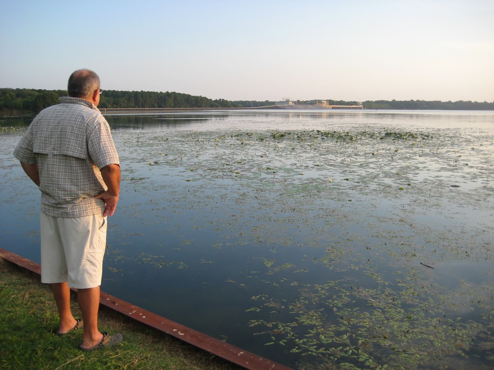
Looking across Lake Seminole toward Woodruff Dam.
Hydrilla and other non-native invasive plants have taken over much of the lake. Perhaps that's why we saw just two boats on the water this weekend.
As we prepped for the move on Sunday morning, what to my eyes did appear, but three tiny ants marching over our threshold. And then, the army followed. The Comet had held them at bay a while. We had powdered around our tires and our hitch -- "anything that touches the ground," just as the camp host instructed. Our investigation revealed their entry point, and our oversight. We had not encircled the electrical box post. The army marched across the electric connection right up to the camper frame, across the underbelly and directly through the door. Much to our dismay, I'm sure we brought some home with us.
Despite the heat and the ants, we delighted in being tourists in our neighboring county, discovering the nearby picturesque landscape and historic exhibits, perpetuating our interest in dams, bridges, and crossing state lines on our bicycles.
Another travel trailer trail tale in the book.
Postscript
Photos Jamie took on March 11, 1998 showing flood waters at the Jim Woodruff dam on Lake Seminole.
On Thursday we traveled south to Damascus, VA. The scenic route through Maryland and West Virginia
afforded us serene views of the countryside.
No doubt, Senator Byrd funneled plenty of federal dollars into his home
state; we felt lonely on a nearly new stretch of interstate that traversed the
West Virginia mountains.
Misty morning as we left Pennsylvania
An overlook in West Virginia
West Virginia scenery
West Virginia
Arriving in Damascus, we met our campsite host, Russell
Hayes, who had saved us a prime site right on the creek. Creekside RV Park has six sites with all the
amenities: water, electricity, sewerage, cable tv and wifi, and it’s
catty-cornered to The Bike Station.
The view from our living room window overlooking the creek in Damascus, VA
Our campsite on the creek running through Damascus, VA
Friday morning we rolled our bikes across the street to meet
our shuttle to Whitetop, VA, where we would begin our day’s ride on the Virginia
Creeper. On the way to the top, we conversed
with a sweet family of four from Tennessee.
The Creeper is a busy trail!
On this day, there were six passenger vans unloading bicycles and
cyclists; and this was just the 10:00 shuttle.
Back in town later, we realized there were dozens of vans, a half dozen
bike shops, and numerous lodging options.
Certainly, the trail has provided an economic boon to Damascus.
At Whitetop, ready to begin our day's ride on the Virginia Creeper
We stepped into the old depot at Whitetop to look around a
bit while waiting until most riders had cleared the area before we mounted our bikes
and headed down the mountain.
The Depot at Whitetop, VA
Mailboxes at the Whitetop Depot
The trail’s
descent from Whitetop to Damascus is steep.
We continually braked to slow our speed; even so, we sped along around 15
miles per hour for much of this 17 mile section. Rain showers during the night made us fear
the trail condition would be poor, but we were pleased to find there were only
a few muddy spots on the entire trail.
Selecting our next Christmas Tree at a farm along the Virginia Creeper
Thought we had waited long enough for the masses to get ahead of us, but some took an early rest stop.
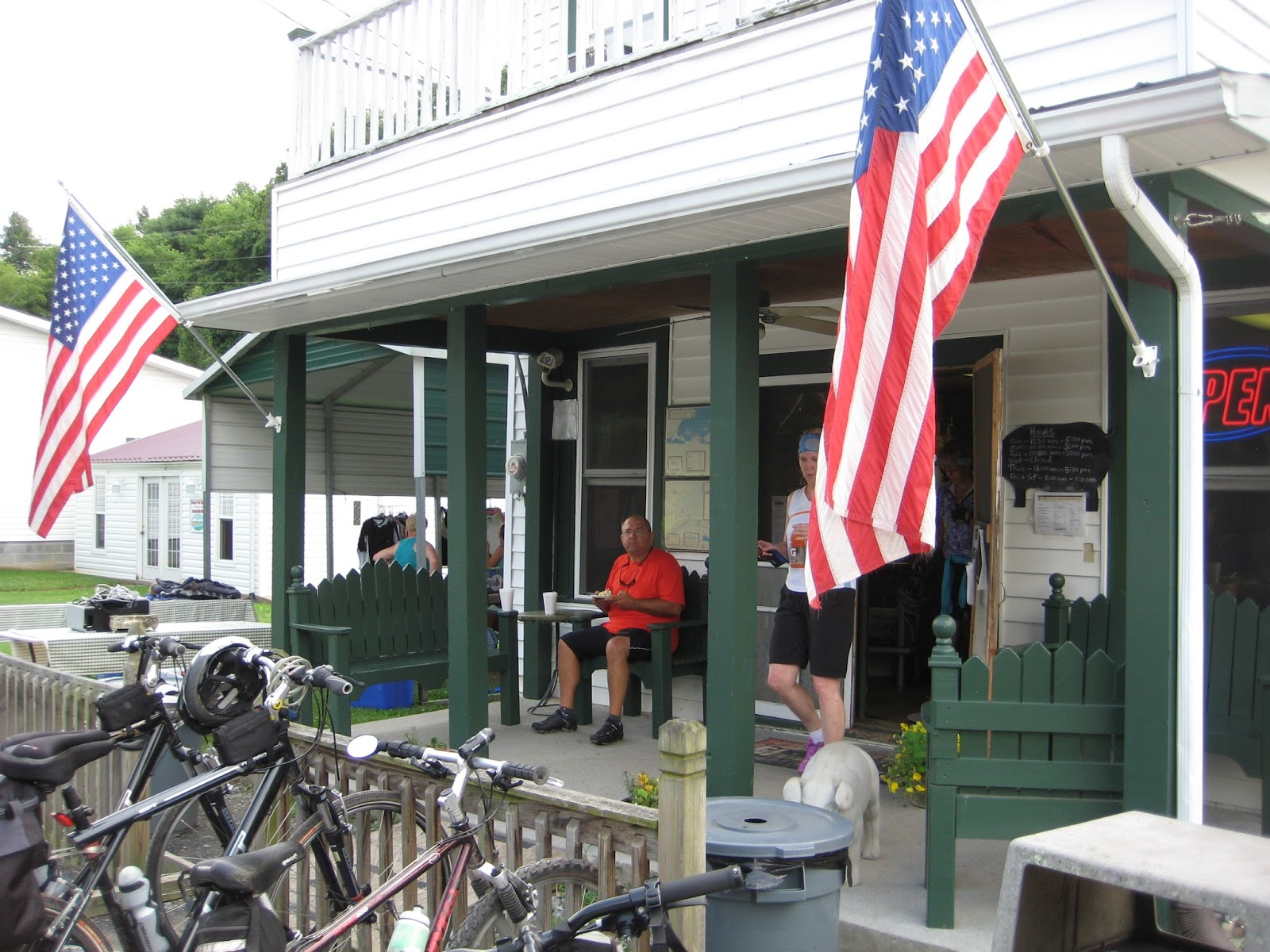
Green Cove Station on the Virginia Creeper; notice the crowd of bicyclists
One of many views of the creek running along the Creeper
At lunchtime, we rolled into Damascus and took a break at
the campsite. A fellow camper had
suggested we do an out-and-back to Alvaredo Station, so we headed back to the trail
for the afternoon. The trail flattened a
bit along this stretch. Sure enough, Alvaredo Station was worth the ride. At a little restaurant on the trail, we
devoured the last serving of banana pudding and gulped a glass of sweet ice
tea.
Alvaredo Station on the Virginia Creeper Rail Trail
On the porch taking a snack break: banana pudding - yum!
By this time, we were just shy of ten miles from the end of
the trail. Surely, we should ride the whole
trail! So we did. We
crossed running creeks and rounded rocky outcroppings. We pushed open cattle gates where the trail
runs through private property. Our legs
could feel the gentle rise in the elevation as we approached Abington, VA.
We passed a cornfield on the trail
This trestle was replaced after a 2011 tornado destroyed it.
Passing through a farm gate on the Virginia Creeper
Rhododendron bloomed throughout the forest
We loved hearing the sound of water rushing over the rocks as we biked the trail
Cows grazed along the trail
Thirty-four miles end-to-end. We biked the Virginia Creeper.
But we were 17 miles from our campsite, a two-hour pedal away.
The return was grueling.
Our pace slowed to 7 mph in some sections. We took only a short break to rest our weary
bottoms and jello legs. By the time we reached Damascus, we had ridden the
equivalent of a half-century, our longest ride ever, and reached a significant
milestone: more than 125 miles biked within a five day span.
Russell had invited us to listen to some bluegrass at one of
the local cafes, but we were later than expected in returning to town and much
too tired for socializing. Instead, we
walked the two blocks to a nearby Mexican restaurant and window-shopped in
downtown Damascus. The food was good, but
at this hour we were the only patrons.
Saturday we’ll head south again, hoping to reach the Peach
State for our last night on the road for this trip.