Showing posts with label West Virginia. Show all posts

Friday, July 17, 2020

Ramblin'

Jamie got a jumpstart on us this morning taking his truck to the local dealership for a new fuel filter.  Brands make a difference!
Sandstone Falls


We picked him up and headed over to the Bleckley Exhibition Coal Mine.  We'd heard it is well-worth the price of admission, but as luck would have it, the exhibit is closed because it's not possible to social distance inside the mine.  We checked out the museum instead.  Then, we traveled on down the road.

We found lunch in Hinton, a neat little town on the New River, and home to an interesting looking railroad museum. We got to look in the window; the lady who runs it is 92 years old and has decided not to open it right now.  Can't blame her.


A few miles further along the river, we wound up at Sandstone Falls.  Definitely worth the drive.  We accessed lovely views of the Falls from a boardwalk.  Fortunately, I had brought my necessary gear along on this trip: camera, remote shutter release, tripod, and ND6 filter.  I just love creating this silky water look!


From Sandstone, we reversed our route to travel to Pipestem Resort State Park.  We jumped on the aerial tram and descended to river level on the Bluestone River.  Talk about a deep drop!  It was a long way down.


What a pleasant final day in West Virginia!  We've thoroughly enjoyed mentally unwinding on these winding mountain roads.  Tomorrow we pack up and head south.  Hiawassee is calling us.

Thursday, July 16, 2020

A Day at the Greenbrier

Our visit to the Greenbrier Hotel in White Sulphur Springs began with temperature checks to be sure we weren't carrying the virus onto the property.  We made our way to the Golf Club for panoramic views of the course and lunch at Sam Sneads.


From there we entered the hotel and found our point of contact in the Trellis Lobby. We let our lunch settle while we awaited our tour guide for the underground bunker.


The Greenbrier Hotel served as a cover for the top-secret Congressional Fallout Shelter from the 60's until 1992 when journalist Ted Gup published an article that revealed the bunker's true purpose, forcing the government to abandon it.  Supposedly, the property lease was terminated and the Greenbrier, which was owned by the C&O Railroad, scrambled to assume operational costs for the space.  Nowadays, the space is supposedly leased by CSX IP for data storage.  Still looks pretty top-secret to me and the fact that we couldn't carry our purse or our phones because of the security risks suggests the data they're securing is, well, pretty secretive.  Wonder if any of that data has my name on it?

The Greenbrier is a lovely resort; we saw quite a few folks enjoying their stay on the tennis courts and the golf course.  We didn't venture downstairs to the casino. Decided to hang on to our coins.

On our return trip to the campground, we stopped by Babcock State Park in hopes of photographing a waterfall and grist mill.  Again, lack of rain meant very little water flow, so the grist mill wasn't in operation.  Despite having left my tripod in the camper (ugh!), I found a rock on which to rest my camera,  and I got lucky with a couple of waterfall shots.
Glade Creek Grist Mill at Babcock State Park


This was also the perfect setting to photograph ourselves.  Brother John did a pretty good job operating my camera for this picture of Jamie and me.


Wednesday, July 15, 2020

Exercisin'

We ended our Tuesday with a ride into town for dinner at Fayetteville's Pies and Pints.  With the cooler weather and lower humidity, we sprawled on a grassy hill under some trees to await our table.  Outdoor dining only. And socially distanced. 

The pizza was differently delicious, but the flatbread with goat cheese and reduced balsamic vinegar is what we'll remember.  This appetizer was served looking like a scoop of vanilla ice cream drizzled with hot fudge sauce with drizzled pizza crust slices.  This, too, was yummy.  We continue to be in awe of how the weather here is suitable for outdoor dining and adventures; we would've been miserable doing this at home in our southwest Georgia climate. 

Stuffed, we headed across the New River Gorge Bridge to the visitor's center for an after-dinner hike down to the observation deck just in time to catch the fading sunset.  Judge for yourself if the view was worth the steps down and back up.  I kicked myself the whole way because I only had my cell phone camera with me, but I upgraded my phone a while back just for such oversights. 

1) Sunset fades behind the New River Gorge Bridge
So, what do you think? Worth 178 steps down and then back up? 

Being back in the camper, we are reminded why we have enjoyed the SolAire so much and we are realizing we have missed her regular adventures far more than we realized.  I think we both sleep better in our little cocoon of a bedroom here with the white noise of the A/C drowning out all the exterior sounds. Ahhh. 

We actually slept in a little later than usual and awoke refreshed on Wednesday morning.  That's what we came for, right?  Jamie sizzled up some bacon on the camp stove and flipped a stack of pancakes for the four of us before we loaded up in the truck - John's truck! - to venture about in the area. 

We found the single lane paved road that winds its way down the gorge by the base of the bridge and then down river just a bit, crossing the railroad tracks and a lower bridge to cross the river and climb out of the gorge.  I don't need to understand the science behind bridge building to know what an awesome sight and incredible engineering feat it is to span a river nearly 800 feet above water level to connect two mountaintops.  I just had to stop frequently to take photographs of multiple views of this man-made wonder.  Fortunately, my travel mates don't seem to mind.

2) Purple wildflowers blooming near the bridge

3) View of the bridge from the railroad tracks

4) view of the bridge from the lower bridge

5) view of the bridge from near the center of the lower bridge

5) arch of the bridge

6) really close to the bridge!

7) view of the ironworks holding up the bridge

8) looking up under the bridge -- you mean we drove over that?
Our next stop for the day was Hawks Nest State Park. We arrived on Wednesday near noon to find that Wednesdays are reserved for servicing the tram that takes visitors down the mountain to the river.  Oh well. I'm not much for swinging cable cars anyway.  Instead, we believed the sign that read "100 steps to spectacular views." 

These steps made last night's steps look like a walk in the park.  Dilapidated (that's a nice word for rotten, isn't it?) railroad ties and steep grades of rough & rocky asphalt led to a rocky outcropping overlooking the river and a train trestle.  We definitely got our sweat on for the day with this midday hike.  The view was pretty.  Not spectacular, but pretty.  No regrets. 
9) view of the bridge in the distance taken from Hawks Nest State Park

10) Watching the train round the bend
11) trestle spanning the river

We continued south along the road we were on and discovered a nearly dry waterfall, Cathedral Falls.  With a full pool, this must be a pretty roadside waterfall, but not today.  I attempted some photographs here, but I wasn't pleased with the final product, so here you'll see a dud! A shady picnic table here was all it took for our crew to unload the cooler & have lunch.
12) Cathedral Falls - much too dry to be attractive
Further south we accessed Kanawha Falls which stretches across the river.  An "antique" power house suggests years of use harnessing the water for electricity.  A shady beach area provided adequate cover for me to read my camera settings and take a few slow exposures to capture the silky water flowing over the rocks. Yes!
13) Kanawha Falls power plant 

14) Kanawha Falls

15) Kanawha Falls

16) Kanawha Falls
Having gotten a bit accustomed to late afternoon naps during COVID closure, some of us were growing weary, so we headed for camp to rest a bit, edit photos, and prepare supper. 

I'll stop here for today.  We've had great day exploring the New River Gorge area.

Now that you've made it to the end of this blog post, which is your favorite photo? They are numbered 1-16. Let me know!


Saturday, June 27, 2015

A Half Century Ride on the Virginia Creeper

On Thursday we traveled south to Damascus, VA.  The scenic route through Maryland and West Virginia afforded us serene views of the countryside.  No doubt, Senator Byrd funneled plenty of federal dollars into his home state; we felt lonely on a nearly new stretch of interstate that traversed the West Virginia mountains.
Misty morning as we left Pennsylvania

An overlook in West Virginia

West Virginia scenery

West Virginia

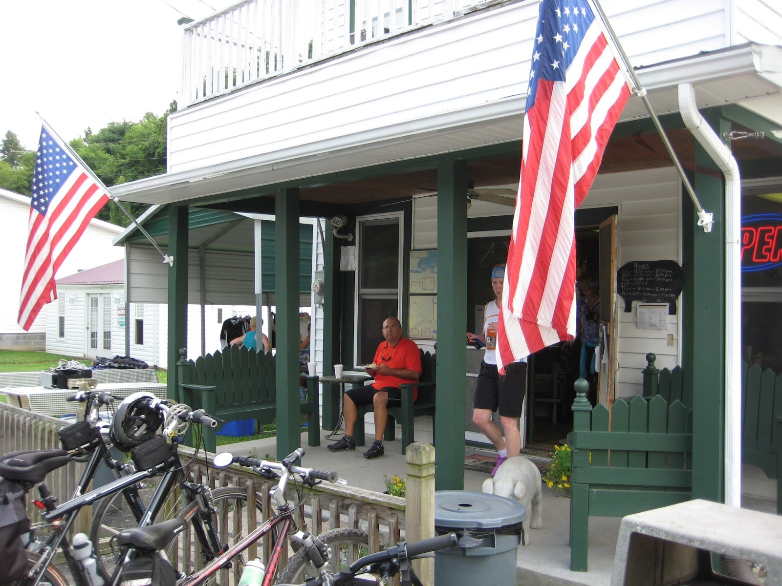
 Arriving in Damascus, we met our campsite host, Russell Hayes, who had saved us a prime site right on the creek.  Creekside RV Park has six sites with all the amenities: water, electricity, sewerage, cable tv and wifi, and it’s catty-cornered to The Bike Station. 

The view from our living room window overlooking the creek in Damascus, VA

Our campsite on the creek running through Damascus, VA
Friday morning we rolled our bikes across the street to meet our shuttle to Whitetop, VA, where we would begin our day’s ride on the Virginia Creeper.  On the way to the top, we conversed with a sweet family of four from Tennessee.

The Creeper is a busy trail!  On this day, there were six passenger vans unloading bicycles and cyclists; and this was just the 10:00 shuttle.  Back in town later, we realized there were dozens of vans, a half dozen bike shops, and numerous lodging options.  Certainly, the trail has provided an economic boon to Damascus.
At Whitetop, ready to begin our day's ride on the Virginia Creeper


We stepped into the old depot at Whitetop to look around a bit while waiting until most riders had cleared the area before we mounted our bikes and headed down the mountain.  
The Depot at Whitetop, VA

Mailboxes at the Whitetop Depot

The trail’s descent from Whitetop to Damascus is steep.  We continually braked to slow our speed; even so, we sped along around 15 miles per hour for much of this 17 mile section.  Rain showers during the night made us fear the trail condition would be poor, but we were pleased to find there were only a few muddy spots on the entire trail.
Selecting our next Christmas Tree at a farm along the Virginia Creeper
Thought we had waited long enough for the masses to get ahead of us, but some took an early rest stop.
 
Green Cove Station on the Virginia Creeper; notice the crowd of  bicyclists 

One of many views of the creek running along the Creeper

 At lunchtime, we rolled into Damascus and took a break at the campsite.  A fellow camper had suggested we do an out-and-back to Alvaredo Station, so we headed back to the trail for the afternoon.  The trail flattened a bit along this stretch. Sure enough, Alvaredo Station was worth the ride.  At a little restaurant on the trail, we devoured the last serving of banana pudding and gulped a glass of sweet ice tea. 
Alvaredo Station on the Virginia Creeper Rail Trail

On the porch taking a snack break:  banana pudding - yum!
 By this time, we were just shy of ten miles from the end of the trail.  Surely, we should ride the whole trail!  So we did.   We crossed running creeks and rounded rocky outcroppings.  We pushed open cattle gates where the trail runs through private property.  Our legs could feel the gentle rise in the elevation as we approached Abington, VA.
We passed a cornfield on the trail
This trestle was replaced after a 2011 tornado destroyed it.

Passing through a farm gate on the Virginia Creeper
Rhododendron bloomed throughout the forest
We loved hearing the sound of water rushing over the rocks as we biked the trail

Cows grazed along the trail

Thirty-four miles end-to-end.  We biked the Virginia Creeper. 

But we were 17 miles from our campsite, a two-hour pedal away.

The return was grueling.  Our pace slowed to 7 mph in some sections.  We took only a short break to rest our weary bottoms and jello legs. By the time we reached Damascus, we had ridden the equivalent of a half-century, our longest ride ever, and reached a significant milestone: more than 125 miles biked within a five day span.

Russell had invited us to listen to some bluegrass at one of the local cafes, but we were later than expected in returning to town and much too tired for socializing.  Instead, we walked the two blocks to a nearby Mexican restaurant and window-shopped in downtown Damascus.  The food was good, but at this hour we were the only patrons.


Saturday we’ll head south again, hoping to reach the Peach State for our last night on the road for this trip.